


1 minute
Strong storms headed our way
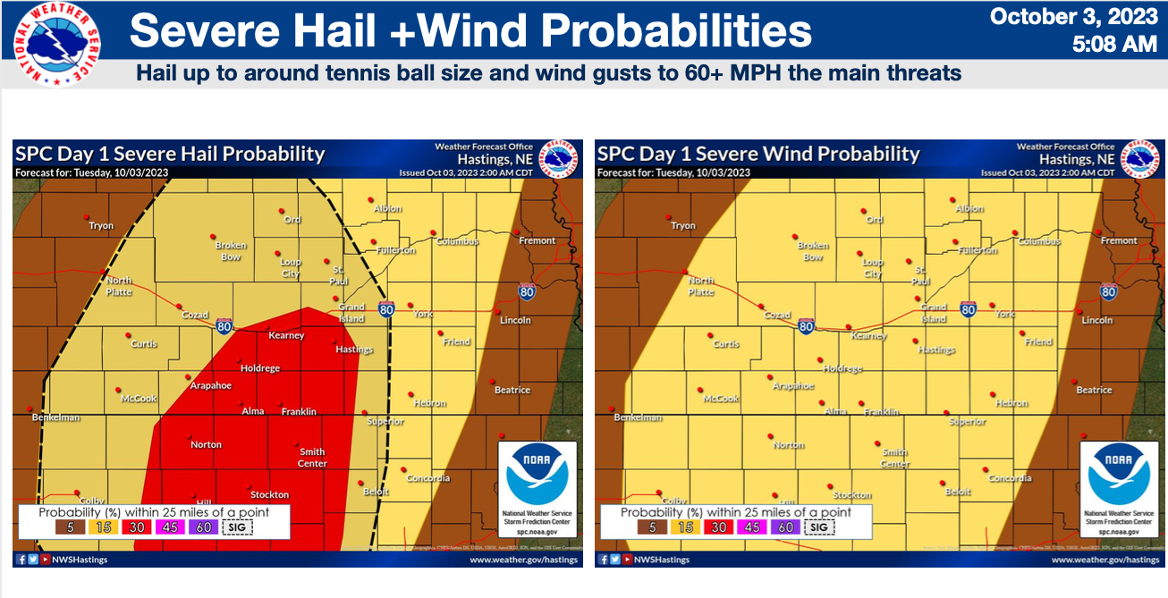
Up to tennis ball-sized hail predicted
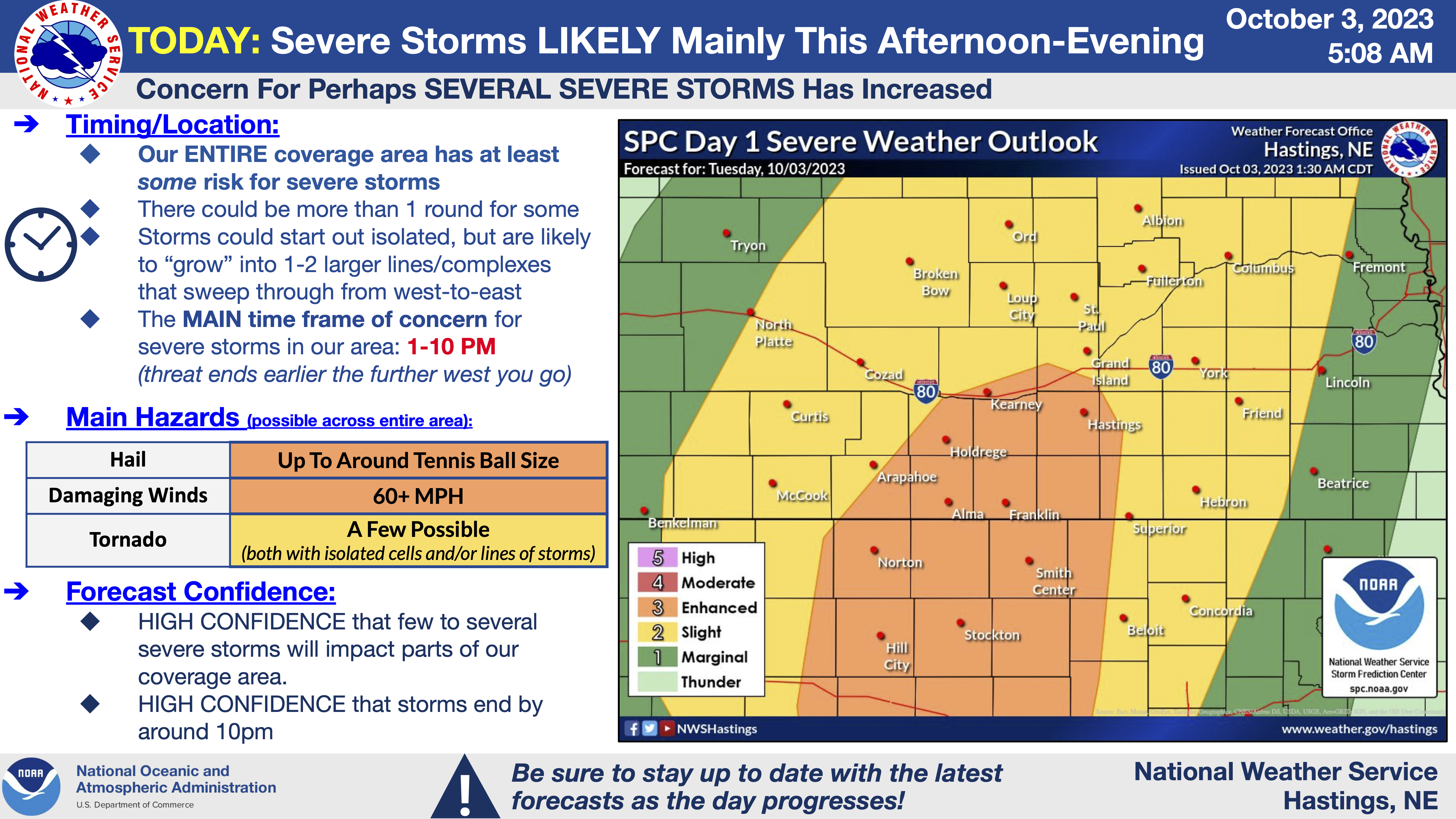
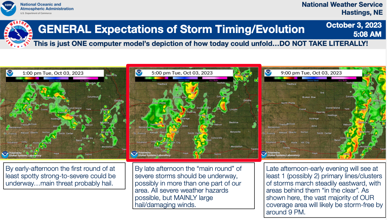
Although many of us are probably welcoming the imminent transition to cooler, more fall-like temperatures, parts of our area could "pay the price" today with an increasing threat of strong to severe thunderstorms, mainly this afternoon-evening (the threat level from the Storm Prediction Center is now up to Enhanced Risk...Level 3 out of 5...for parts of our coverage area). Please see the attached PDF for more details/visuals, but a couple of the very basic MAIN POINTS are as follows:
1) The vast majority of possible severe storms will occur between 1-10 PM, with activity steadily departing our area from west to east late this afternoon-evening
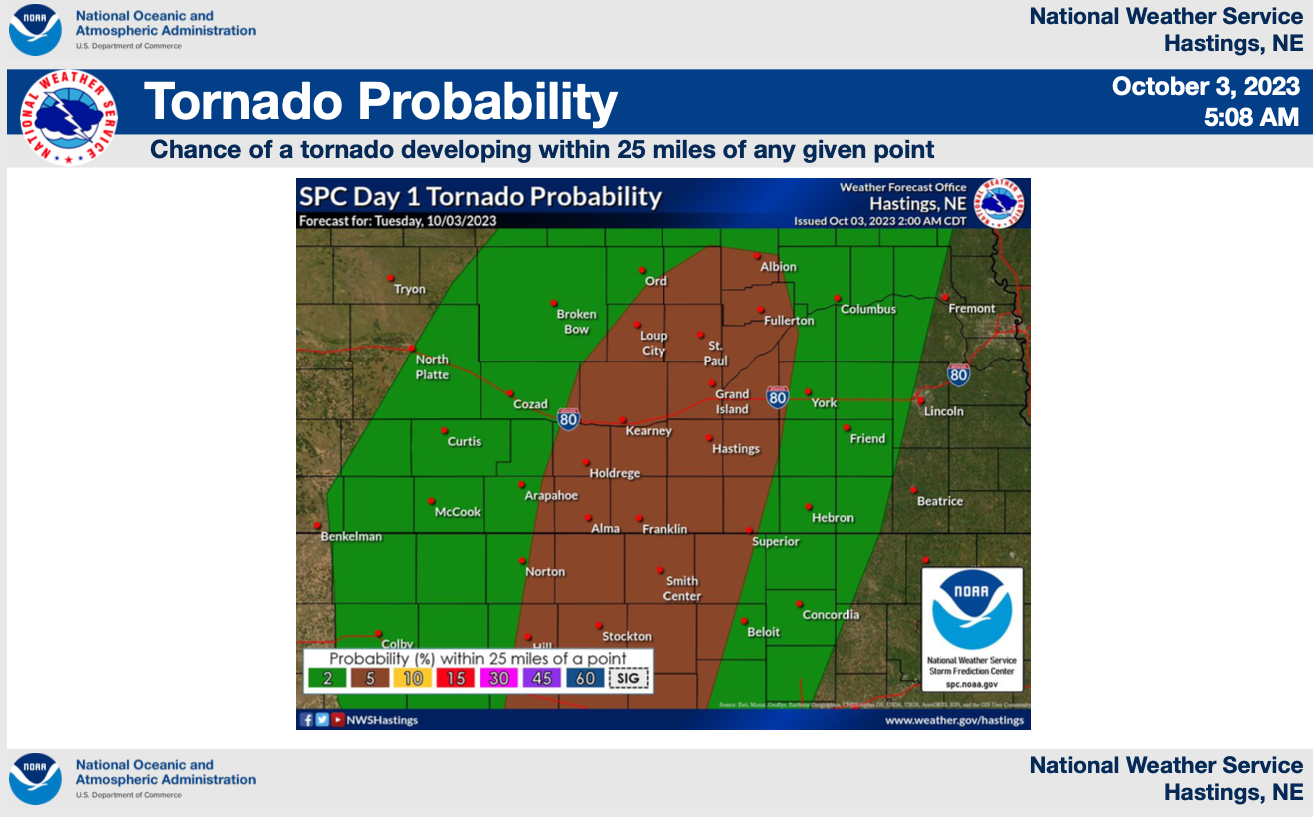
2) Large hail (some very large) and damaging winds are the MAIN threats, but a few tornadoes are also possible (both with any isolated storms and also perhaps embedded within more prominent lines of storms)